Slope, clearance, steps, surface condition and entrances can stop deployment even when autonomy is ready.
ROBOT MOBILITY INTELLIGENCE
Make the real world
legible to robots.
Robots are becoming more capable, but real deployment still depends on the world around them. Movewise Lab builds the spatial-intelligence layer between physical places and autonomous machines, helping teams understand where robots can operate before trial-and-error begins in the field.
Working MVP4 patent applications filedPublic-sector project underway
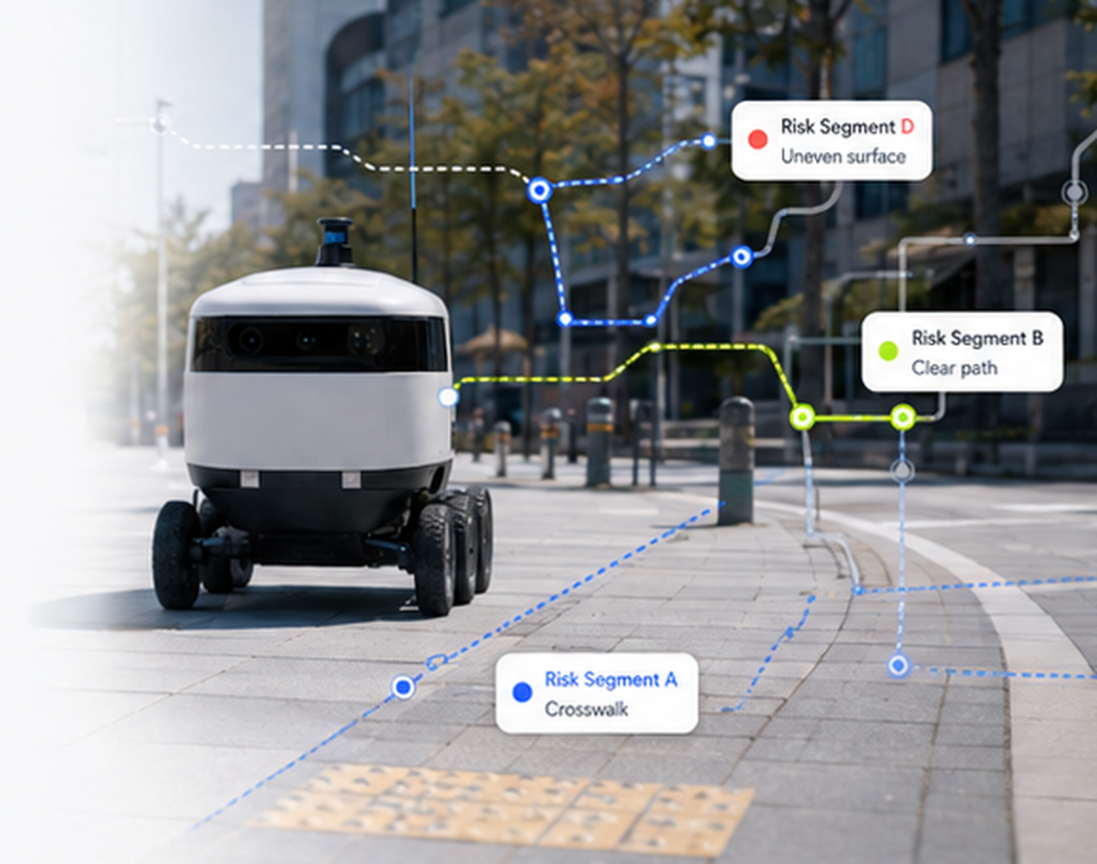
RS-NexusMeasured spatial evidence → robot-specific decisions
Why this matters
Smarter robots still need
a world they can read.
a world they can read.
Human maps tell us where places are. Real robot deployment requires another layer: whether a machine can actually pass, stop, turn, enter and operate safely in that space. Small physical constraints can decide whether an otherwise capable robot service succeeds or fails.
A route suitable for one platform may be constrained or risky for another.
Measure and compare operating conditions before repeated trial-and-error in the field.
Product
RS-Nexus turns field evidence
into operational intelligence.
Conventional maps describe where things are. RS-Nexus focuses on whether a robot can actually operate there—using clearance, slope, steps, surface quality, obstacles, crowding, continuity, entrances and building connections as measurable evidence.
01
Robot Score
Quantifies robot-specific traversability and operational risk at the segment level using measured environmental attributes.
CORE METRIC
02
Robot Readiness Index
Assesses whether a campus, complex, building or district is ready to support a target robot service.
SPACE-LEVEL INDEX
03
RS-Map
Visualizes traversable, caution and improvement-needed segments so deployment teams can compare operating areas and routes.
DECISION MAP
04
RS-Connect
Delivers spatial intelligence through reports, map layers, APIs and robot-ready outputs for planning, validation and system integration.
DATA / API LAYER
Technology
Measured first.
Reasoned second.
Our architecture separates physical measurement from higher-level interpretation. This keeps robot mobility decisions grounded in observable spatial evidence while leaving room for explainable AI-assisted reasoning.
RGB · Depth · GNSS
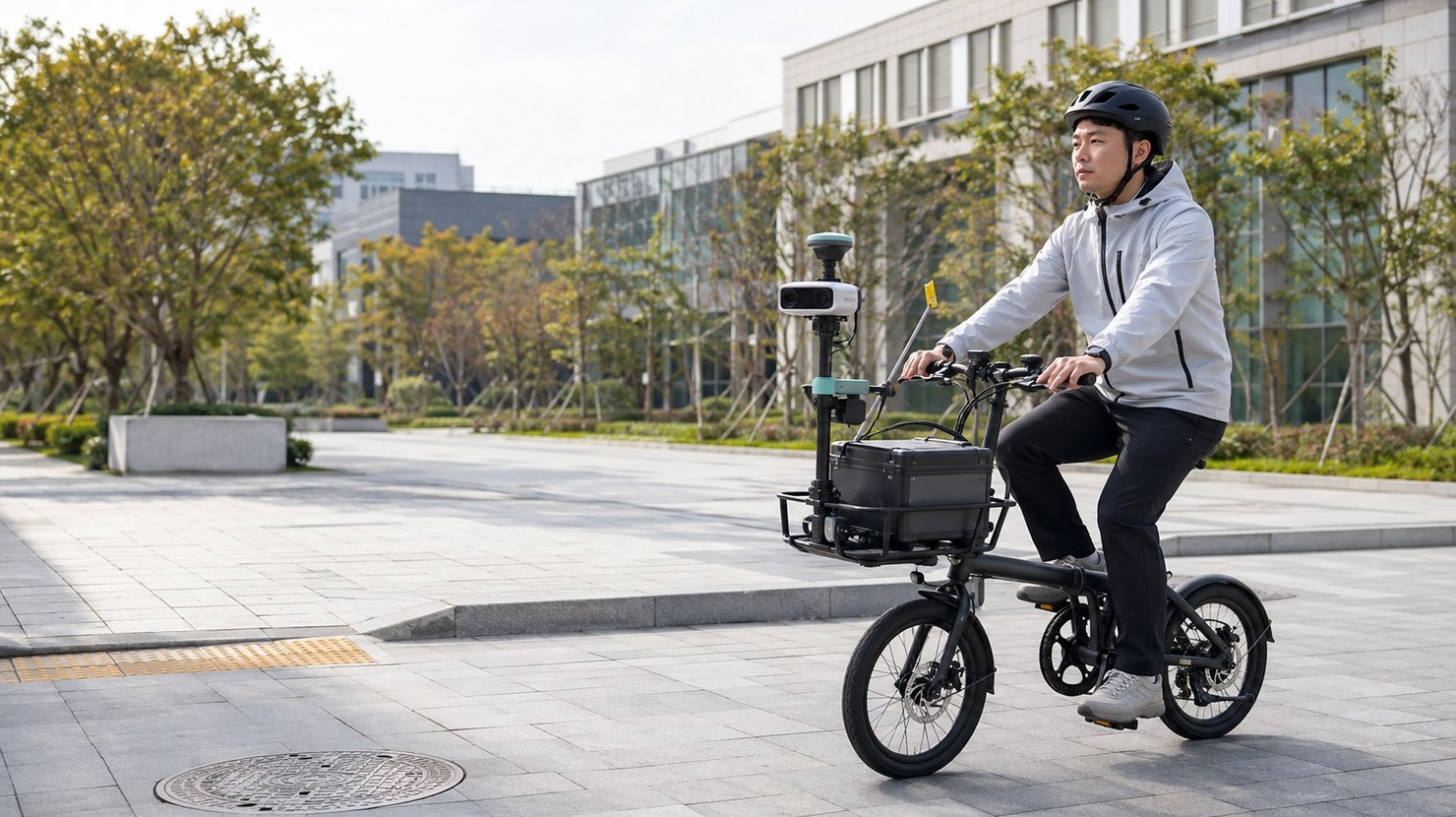
Collect field observations that capture geometry, surface conditions and objects in real operating environments.
GIS · Links · Costmaps
Structure observations by location and route context, connecting field evidence to spatial segments and robot navigation layers.
Robot Score · Route Risk
Evaluate the same space differently according to each robot’s dimensions, mobility limits and operating requirements.
Map · API · Operational Insight
Turn analysis into outputs that robot operators, manufacturers and public-sector partners can use in deployment decisions.
Working prototype
From field evidence
to a working spatial-data pipeline.
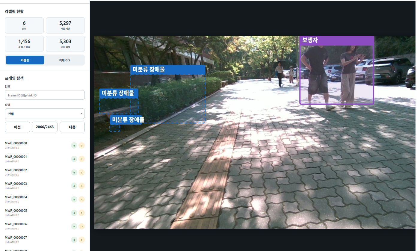
Our MVP connects evidence review, environmental analysis, passability assessment and route diagnostics in one workflow. We continue to refine it through field data, validation and real deployment use cases.
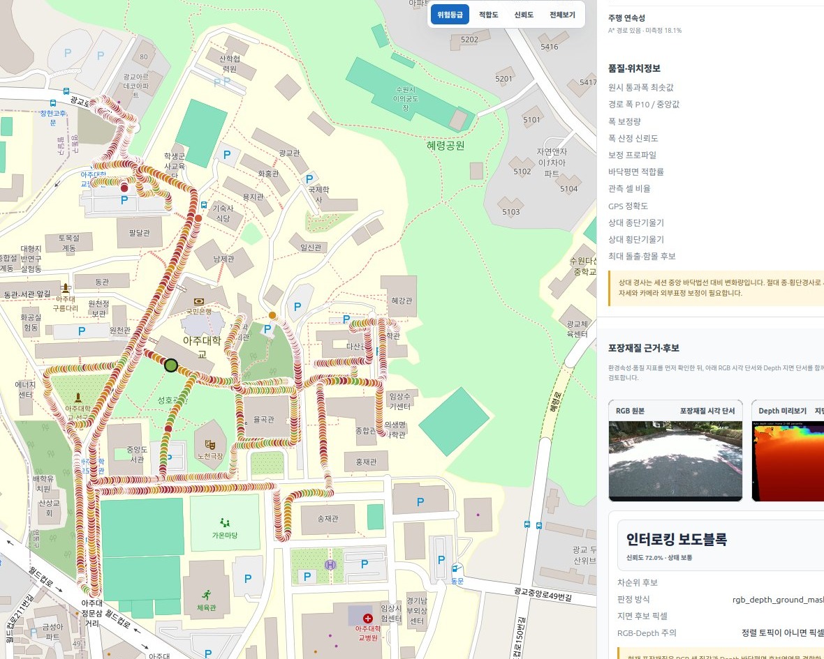
01 · EVIDENCE GIS
Keep every decision traceable to field evidence.
Survey routes, RGB frames and detected objects remain connected to the same spatial context for review and validation.
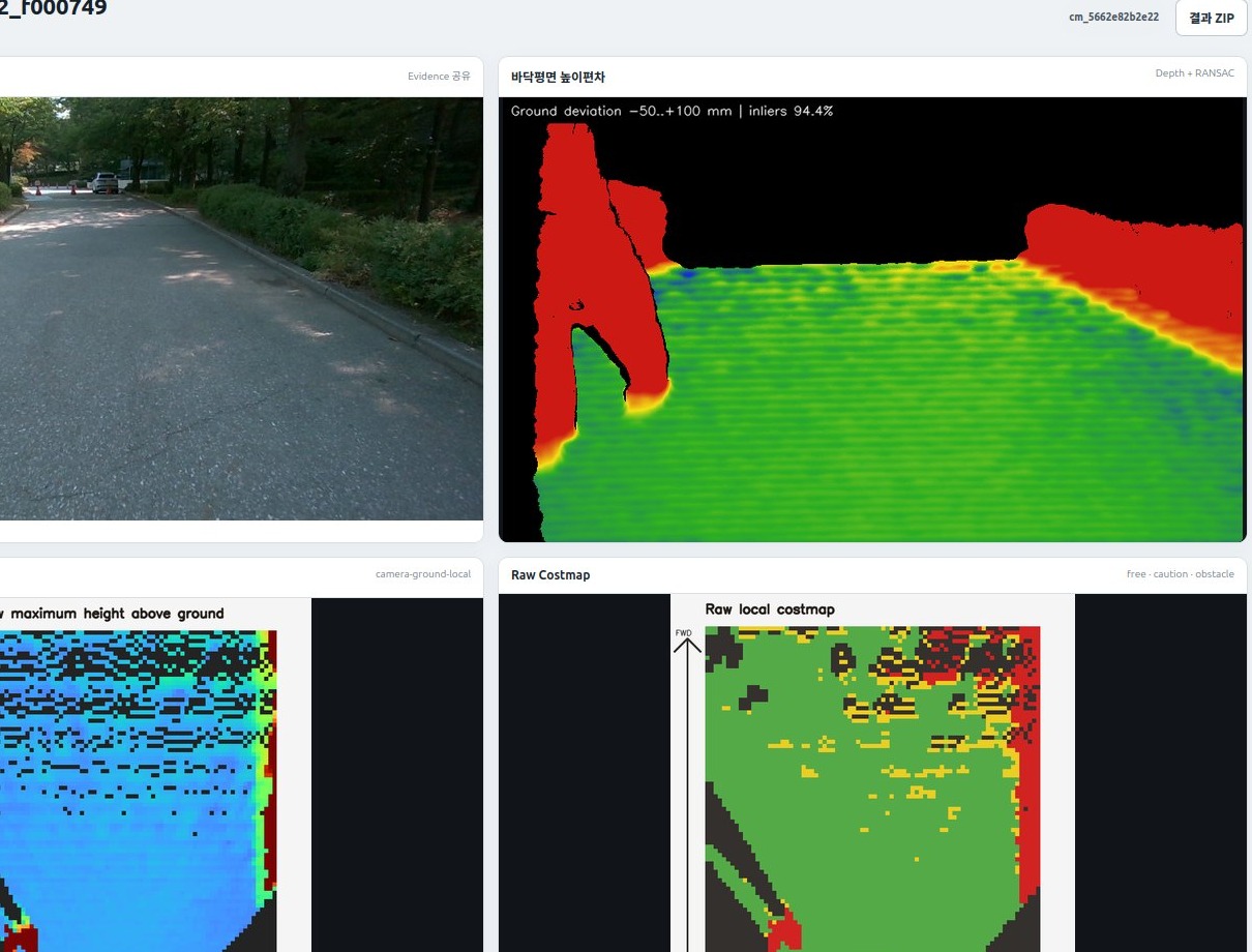
02 · ENVIRONMENT ANALYSIS
Structure the conditions that affect mobility.
Translate field observations into comparable environmental attributes and identify risk segments that require caution or improvement.
03 · PASSABILITY / COSTMAP
Connect spatial evidence to navigation context.
Use robot-specific operating constraints to distinguish traversable space from constrained or higher-cost areas.
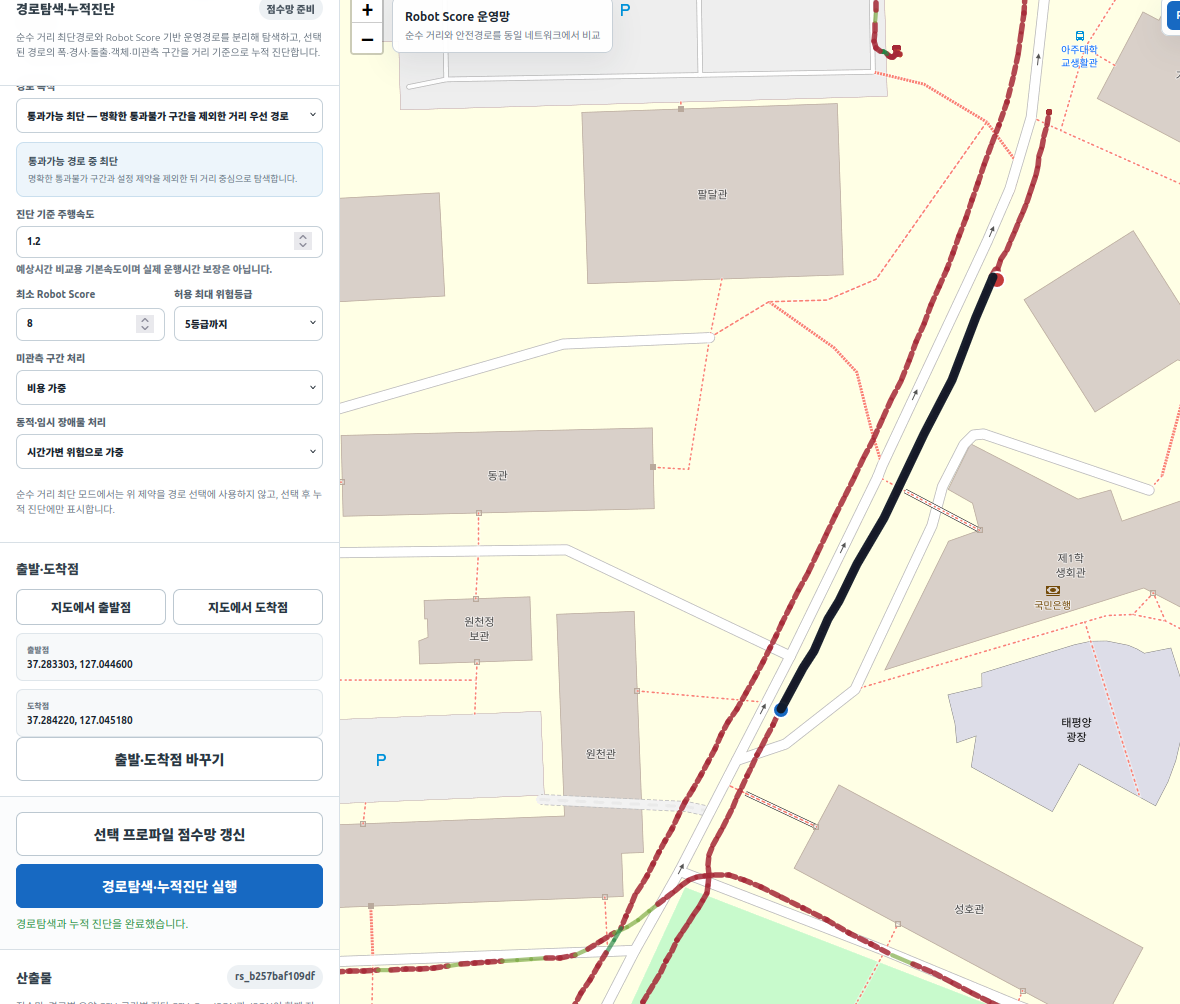
04 · ROUTE DIAGNOSIS
Explain why one route is better suited than another.
Compare routes with segment-level risk and operating conditions instead of relying on shortest distance alone.
Grounded AI layer · in development
From measured attributes
to explainable decisions.
We are developing an AI reasoning layer above RS-Nexus that can synthesize measured spatial attributes with robot-specific operating constraints. The goal is to explain route risk, compare deployment options, and answer operational questions in clear, grounded language.
The AI layer is designed to complement—not replace—the measured evidence, scoring logic and spatial data beneath it.
Who we serve
One environmental dataset.
Different operational decisions.
The same physical environment can be interpreted differently depending on a robot’s size, mobility limits and service requirements. Movewise Lab provides a common spatial-data foundation that can be re-evaluated for different users.
01Robot operators
02Robot manufacturers
03Public sector
04Campuses & complexes
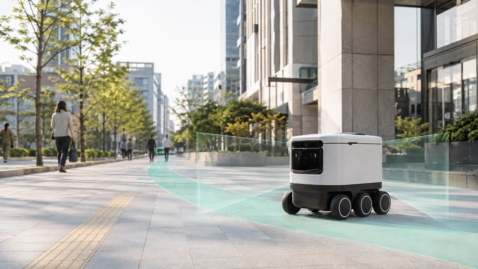
Our vision
Make robot readiness
a measurable property of place.
Today we ask whether a robot can handle the world. We also need to ask whether the world is ready for the robot. Our long-term goal is to make that readiness visible, comparable and actionable across streets, campuses, buildings and public spaces—so deployment decisions rely less on trial and error, and people and robots can move together more safely and predictably.
Traction
Early-stage,
but already in motion.
Movewise Lab was incorporated in 2026 and is building from a working product base, field data, intellectual property and early public-sector execution—not from an idea alone.
Working MVPRS-Nexus with evidence GIS, environmental analysis, passability/costmap and route diagnostics
4 patent applicationsFiled around robot mobility, safety and spatial-intelligence technologies
Public-sector projectInitial public-sector project underway in Korea
Startup programsSelected for KISED’s Pre-Startup Package and KAIA’s NEXT Challenge
MAY 2026
KISED
Selected for KISED’s 2026 Pre-Startup PackageJUN 2026
GBSA
Selected as a resident company at Gyeonggi Startup Innovation SpaceJUL 2026
INCORPORATION
Movewise Lab Inc. incorporated in South KoreaJUL 2026
LAND & TRANSPORT
Selected for KAIA’s land and transport startup program, NEXT ChallengeCompany
A Korean spatial-intelligence startup
focused on the space between maps and machines.
Movewise Lab began with a simple gap we repeatedly saw in mobility systems: maps describe space for people, while robots need operational evidence about whether they can actually move through it. We combine transportation engineering, field sensing, GIS and robot navigation data to close that gap—and to turn physical environments into a form machines can reason about and people can inspect.
Legal nameMovewise Lab Inc.
Korean legal name주식회사 무브와이즈랩
Founder & CEOIngon Ryu, Ph.D.
FoundedJuly 2026
HeadquartersSuwon, Gyeonggi-do, Republic of Korea
Official domainmovewiselab.com
Contact[email protected]
Values & principles
Build for shared space.
Does what we build help people and robots move safely together,
and help create places where robot services can actually work?
01
Safety starts with people
We prioritize safe, predictable coexistence with people over robot efficiency alone.
02
Evidence before intuition
We ground operational decisions in measured field data, explainable criteria and spatial context.
03
Built for deployment
We carry research and analysis into working software, field validation, PoCs and operational use.
PoC / Partnership
Is your operating area
ready for robot services?
We work with robot companies, public agencies, campuses and complex operators to understand deployment readiness, identify route risks and design field PoCs grounded in real spatial evidence.